Tag Archives: mapping

Emma Griffin talking walking

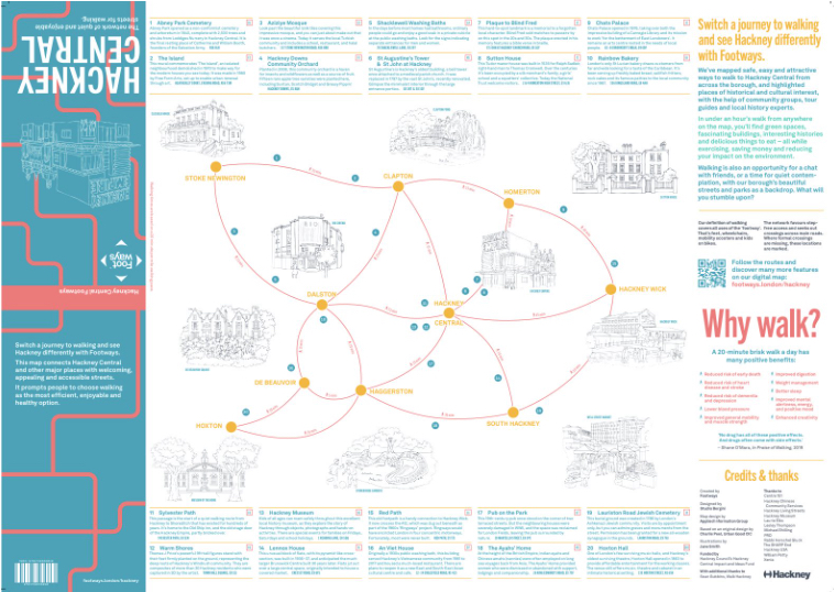
Emma Griffin is a transport journalist, turned pedestrian activist, and maker of Footways maps of London, that identify calm and pedestrian-friendly routes and streets for us on foot to enjoy. One such route is the canal-side towpath, that Emma and Andrew Stuck walk along when they meet at Haggerston in Hackney, or so it should be, however, they have to share the path with inconsiderate cyclists. Emma argues that cyclists are part of the solution towards a more pedestrian-friendly London, as are Low Traffic Neighbourhoods, and the real battle is with the car drivers. 26’09” 12.3MB

Download notes of items mentioned in the interview with Emma Griffin:

Ben Clifford talking walking

Ben Clifford, was almost stranded in Melbourne at the beginning of lockdown. He returned home to Croydon on almost the last flight leaving Australia. With time on his hands, he began mapping and walking the parish boundaries of this large outer London borough. Several weeks later, having walked hundreds of miles, Ben has traced out 8 interconnected walks and called his project “Beating the Bounds”. Having walked the boundary of the London borough of Greenwich, Andrew Stuck was interested to find out what Ben had discovered. They meet on Conduit Lane, close to the start of the Vanguard Way, a long distance trail from Croydon to the south coast. 25’ 10″ 11.8 MB

Download notes of items mentioned in the interview with:

Map of Croydon walks and boundary posts created by Ben Clifford